Lightning Map - GOES-16 Near Real-Time Lightning

Lightning Map - GOES-16 Near Real-Time Lightning

Practical Tools 1.0
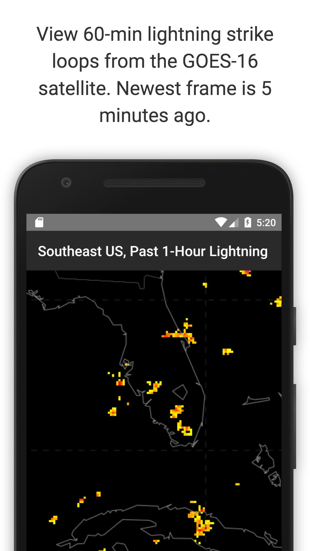
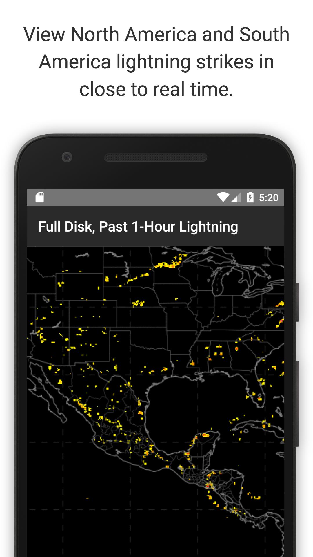
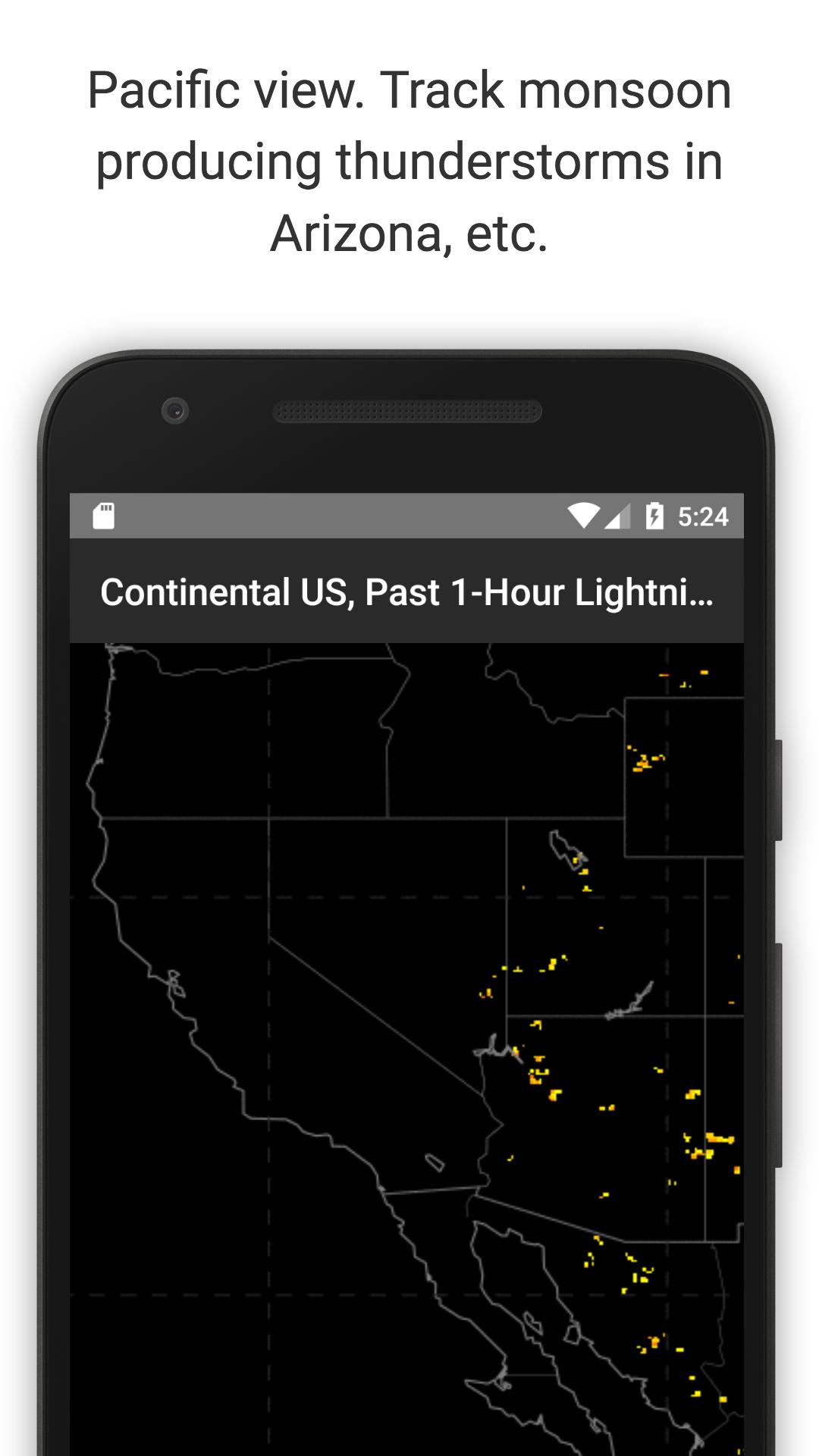
Satellite lightning maps with only 5 min lag. One-hour loops, one frame per minDisplays near real-time lightning flash observations from the GO
1.0

Screenshots

Description

Satellite lightning maps with only 5 min lag. One-hour loops, one frame per min

Displays near real-time lightning flash observations from the GOES-16 GLM satellite.

Each loop shows the past one hour of data (approx. 60 frames). The most recent frame is usually less than 5 minutes old.

Measures total lightning (in-cloud, cloud-to-cloud, and cloud-to-ground).

Spatial resolution is 10 km.

The group density looks at aggregate flashes in a one minute time window and assigns a color code described in the bottom of the respective loop.

GOES: Geostationary Operational Environmental Satellite

GLM: Global Lightning Mapper

This app comes with no warranty.

What's New in the Latest Version 1.0

Last updated on Jul 23, 2017 Initial release

Expand

Other Information

  • Release Time

    2025/04/27

  • Size

    2.23MB

  • Category

    Practical Tools
  • Package Name

    com.davidgrossapps.lightningmap